Depannage Lybaert, a towing company in Ghent, priced every transport job with a route planner, a rate sheet and the official toll calculator in separate windows. Now they type the addresses and press one button. To get there we first had to build the map of Belgium's tolled roads, because it turned out not to exist as data.

Depannage Lybaert tows, recovers and transports vehicles out of Ghent. Day and night, from a breakdown around the corner to a transport across half the country. Their question was simple: can we automate the pricing of those jobs?
The starting point
The price of a job depends on more than you would think. The distance, the type of vehicle, regular client or private customer, day or night, the diesel surcharge of that moment, and the kilometre charge the tow truck itself pays. Every piece came from a different window. The distance from a route planner, the toll from the official calculator, the surcharge from a table, and then everything combined in a spreadsheet. For every quote, again.
What we built
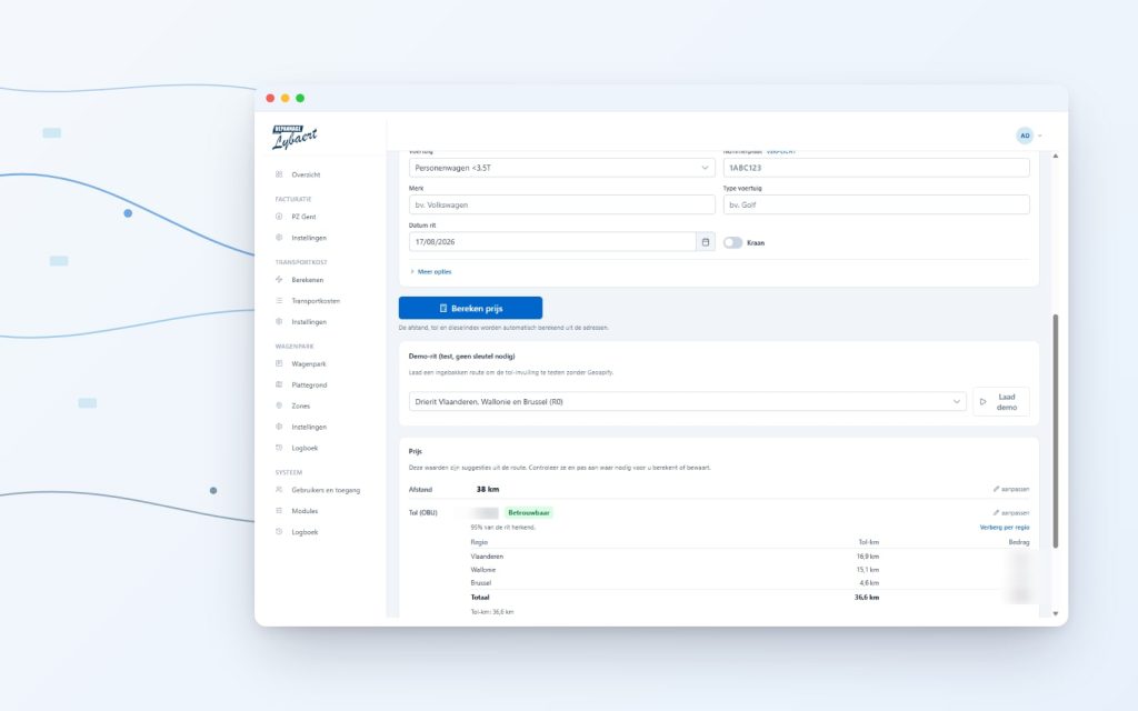
One page in their own platform. You type the addresses, with suggestions as you go, and press Calculate. The price appears, with the full breakdown next to it. Distance, toll, surcharges, VAT. Every figure stays editable, because the person at the screen keeps the final say. Calculations are saved, so last month’s price is one search away. The diesel surcharge keeps itself up to date.
The map that wasn’t there
The hard part was the kilometre charge. Trucks over 3.5 tonnes pay per kilometre on certain Belgian roads, and since this summer in the Netherlands too. If you want to compute that charge up front, you need to know exactly which roads are tolled. And that is where it gets interesting.
Wallonia publishes its tolled roads as open data. So does the Netherlands. Brussels is easy, the charge applies almost everywhere there. But Flanders, of all regions the one where a Ghent towing company drives most, only has a PDF map and an annex to a decree. Ninety-six lines of text. Sometimes clean (“the A1”), sometimes a description like “up to the junction with the N348”, and in one case literally a house number.
So that became the job. Converting the decree line by line, joining it to the government’s public road register, and checking the port area by hand against the official map. The result is our own toll map of some 48,000 road segments, together nearly 20,000 kilometres of tolled road across Belgium and the Netherlands.
Does it hold up?
A map that looks nice is worthless if the euros are off. So we priced 35 real routes and put them next to the official kilometre charge calculator. 32 of the 35 came out within one euro, and the worst was less than two and a half euros off, on a route around the Antwerp ring. The platform fills in the toll as a suggestion, the operator confirms or adjusts.
Why build it
There are services that rent out toll calculations, per month, with terms attached. For many companies that is the right choice, and we said so. Here it weighed differently. No monthly cost, no vendor in between, and the map now simply belongs to them. Upkeep is one maintenance round a year, when the rates and the decree change.
The platform does more by now
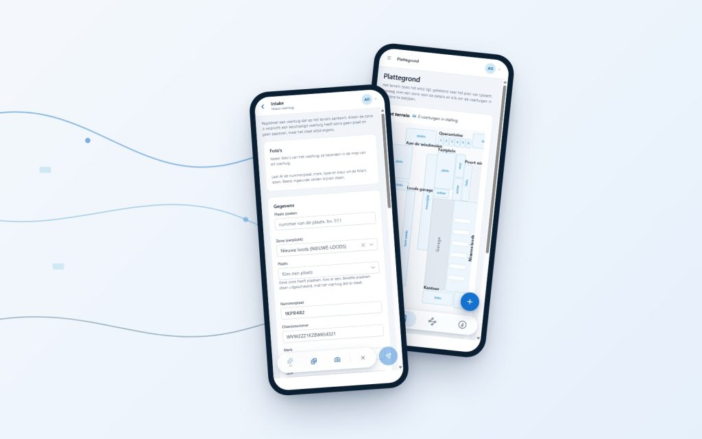
The price calculation wasn’t the first piece. The same platform handles the daily cash desk and payments, and the inventory of stored vehicles. There you take a photo of a car in the yard and AI reads the plate and the chassis number, after which the file fills itself in. With a map of the site down to the individual parking spot. Grown step by step, each time from a concrete irritation.
And you?
Still pricing jobs with four windows side by side? Let us have a look. The first look is free and without obligation.